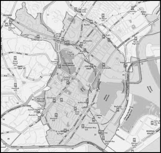
| (1) | Generally south-west along Nicoll Highway until its junction with Rochor Road; |
| (2) | Generally south-east along Rochor Road towards the ERP facility on the slip road into Temasek Boulevard from Rochor Road; |
| (3) | Generally south-east along an imaginary line around the circumference of Suntec City Mall towards Temasek Avenue; |
| (4) | Generally south along Temasek Avenue until its junction with Raffles Boulevard; |
| (5) | Generally east along Raffles Boulevard towards the ERP facility between the junction of Republic Boulevard and Republic Avenue and the junction of Republic Boulevard and Raffles Boulevard on the southbound carriageway; |
| (6) | Generally south-east along an imaginary straight line towards the banks of Marina Reservoir at Marina Promenade; |
| (7) | Generally south and east along the banks of Marina Promenade until its junction with Bayfront Bridge; |
| (8) | Generally south and along Bayfront Bridge towards Sheares Avenue; |
| (9) | Generally south along Sheares Avenue towards the ERP facility between the point where East Coast Parkway meets Sheares Avenue and the junction of Sheares Avenue and Sheares Link on the westbound carriageway; |
| (10) | Generally south-west along Sheares Avenue until its junction with Central Boulevard; |
| (11) | Generally south-east along Central Boulevard until the ERP facility between the junction of Central Boulevard and Marina Gardens Drive and the junction of Central Boulevard and Sheares Avenue on the northbound carriageway; |
| (12) | Generally north-west along Central Boulevard from the ERP facility between the junction of Central Boulevard and Marina Gardens Drive and the junction of Central Boulevard and Sheares Avenue on the northbound carriageway until its junction with Sheares Avenue; |
| (13) | Generally south-west along an imaginary straight line until Marina Coastal Expressway; |
| (14) | Generally west along Marina Coastal Expressway until its junction with Keppel Road; |
| (15) | Generally west along Keppel Road until its junction with Cantonment Road; |
| (16) | Generally north-east along Cantonment Road until its junction with Cantonment Close; |
| (17) | Generally east and north around the circumference of The Pinnacle @ Duxton until the junction of Neil Road and Cantonment Road; |
| (18) | Generally north-west along Cantonment Road until its junction with Eu Tong Sen Street; |
| (19) | Generally north-east towards the ERP facility between the junction of Eu Tong Sen Street and Cantonment Road and the point where Eu Tong Sen Street meets Pearl’s Hill Terrace on Eu Tong Sen Street on the northbound carriageway; |
| (20) | Generally north-east along Eu Tong Sen Street until Lot TS22‑00178W; |
| (21) | Generally north-west and north-east around the circumference of Lot TS22‑00178W towards Pearl’s Hill Terrace; |
| (22) | Generally north along Pearl’s Hill Terrace until 18 Pearl’s Hill Terrace; |
| (23) | Generally north-east and north-west around the circumference of 18 Pearl’s Hill Terrace; |
| (24) | Generally north along an imaginary straight line through Pearl’s Hill City Park until its junction with Pearl’s Hill Road; |
| (25) | Generally north-east along Pearl’s Hill Road until its junction with Upper Cross Street; |
| (26) | Generally north-east and north-west along Upper Cross Street until its junction with Chin Swee Road; |
| (27) | Generally north-east along an imaginary line towards the ERP facility between the junction of Havelock Road and Clemenceau Avenue and the junction of Havelock Road and Magazine Road on Havelock Road; |
| (28) | Generally north-east along an imaginary line towards the ERP facility between the junction of Merchant Road and Clemenceau Avenue and the point where the Central Expressway slip road exiting to Merchant Road meets Merchant Road on Merchant Road on the southbound carriageway; |
| (29) | Generally north-east and north along Clemenceau Avenue until its junction with Oxley Rise; |
| (30) | Generally north-west along Oxley Rise towards Eber Road; |
| (31) | Generally west along Eber Road towards Exeter Road; |
| (32) | Generally north-west along Exeter Road towards Devonshire Road; |
| (33) | Generally north-west along Devonshire Road towards Orchard Boulevard; |
| (34) | Generally north-west along Orchard Boulevard until its junction with Orchard Link; |
| (35) | Generally north-east along Orchard Link towards the ERP facility between the junction of Orchard Link and Orchard Road and the junction of Orchard Link and Somerset Road on Orchard Link on the northbound carriageway; |
| (36) | Generally north-east along Orchard Link past the ERP facility between the junction of Orchard Link and Orchard Road and the junction of Orchard Link and Somerset Road on Orchard Link on the northbound carriageway until its junction with Orchard Turn; |
| (37) | Generally north-west along Orchard Turn until the ERP facility after the entrance into Orchard Turn from Orchard Boulevard on Orchard Turn on the northbound carriageway; |
| (38) | Generally north-east along an imaginary line in between Ion Orchard and Wisma Atria until Orchard Road; |
| (39) | Generally north-west along Orchard Road until the ERP facility between the junction of Orchard Road and Scotts Road and the junction of Orchard Road and Mount Elizabeth on Orchard Road; |
| (40) | Generally south-west along Orchard Road from the ERP facility between the junction of Orchard Road and Scotts Road and the junction of Orchard Road and Mount Elizabeth on Orchard Road until the area separating Tang Plaza from Lucky Plaza; |
| (41) | Generally north-east and north-west along an imaginary line along the area separating Tang Plaza from Lucky Plaza and along the rear of Scotts Square, Grand Hyatt Singapore and Far East Plaza until Mount Elizabeth; |
| (42) | Generally north-west along Mount Elizabeth until the end of Mount Elizabeth; |
| (43) | Generally north-east, east and south along an imaginary line around High Point and the rear of Ritz‑Carlton Residences, Singapore, Cairnhill, Elizabeth Heights and Cairnhill Plaza towards the ERP facility between the point where Cairnhill Road meets Cairnhill Circle and the junction of Cairnhill Road and Mount Elizabeth Link Road on Cairnhill Road on the southbound carriageway; |
| (44) | Generally south-east and north-east along an imaginary line around the circumference of Cairnhill Crest towards Cairnhill Circle; |
| (45) | Generally east along an imaginary straight line until the rear of 166 Emerald Hill Road; |
| (46) | Generally south along an imaginary line from the rear of 166 Emerald Hill Road until the rear of 57 Cuppage Road; |
| (47) | Generally south-east along an imaginary line from the rear of 57 Cuppage Road towards Cavenagh Road; |
| (48) | Generally south-east along Cavenagh Road until its junction with Kramat Road; |
| (49) | Generally south-east along Kramat Road towards the ERP facility between the slip road from Kramat Road into the Central Expressway and the junction of Kramat Road and Cavenagh Road on Kramat Road; |
| (50) | Generally south-east along Kramat Road past the ERP facility between the slip road from Kramat Road into the Central Expressway and the junction of Kramat Road and Cavenagh Road on Kramat Road until its junction with Buyong Road; |
| (51) | Generally south along Buyong Road until its junction with Orchard Road; |
| (52) | Generally east along Orchard Road until Plaza Singapura; |
| (53) | Generally north-east along an imaginary line from the circumference of Plaza Singapura until Sophia Road; |
| (54) | Generally north-east along Sophia Road until its junction with Mackenzie Road; |
| (55) | Generally north-east along Mackenzie Road until 131 Mackenzie Road; |
| (56) | Generally south-east along an imaginary line from 131 Mackenzie Road towards Mount Emily Road; |
| (57) | Generally south-east along Mount Emily Road for a distance of approximately 70 metres; |
| (58) | Generally north-east along an imaginary straight line towards Mackenzie Road; |
| (59) | Generally south-east along Mackenzie Road until its junction with Selegie Road; |
| (60) | Generally north-east along Selegie Road until its junction with Rochor Canal Road; |
| (61) | Generally south-east along Rochor Canal Road until its junction with Rochor Road; |
| (62) | Generally south-east along Rochor Road until its junction with Nicoll Highway; and |
| (63) | Generally north-east along Nicoll Highway until the ERP facility between the junction of Nicoll Highway and Republic Avenue and the point where Ophir Road Flyover crosses Nicoll Highway, |