2. Item (4) in the Schedule to the Protected Areas (Consolidation) Order (O 15) is deleted and the following item substituted therefor: | | | | | | (4) Camp Commandant,
Changi Naval Base |
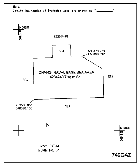
| | | CHANGI NAVAL BASE SEA AREA. |
| | | | All that area comprised in part of State Land Lot 4229N in Mukim No. 31 and part of foreshore within the territorial waters of the Republic of Singapore occupied by “CHANGI NAVAL BASE SEA AREA” containing an area of about 4,234,740.7 square metres and bounded approximately as follows: |
| | | | Commencing at a point of the aforesaid “CHANGI NAVAL BASE SEA AREA” which point is 33,176.976 metres North and 50,198.632 metres East of the Singapore Land Authority SVY21 Datum, the boundaries run along successive lines of co-ordinates approximately as follows: |
| | | | | | | | | | | | | | | | | | | | | | | | | | | | | | | | | | | | | | | | | | | | | | | | | | | | | | | | | | | | | | | | to the point of commencement. |
| | | | The boundaries of “CHANGI NAVAL BASE SEA AREA” are more particularly delineated on the Survey Plan No. 749GAZ filed in the office of the Director, Building and Infrastructure Services, Defence Science and Technology Agency, Singapore, a copy of which is set out below. |
| |
|
[G.N. Nos. S 216/2006; S 158/2007; S 645/2007] |